Die Wolf-Schneider-KI
Online - Beta 0.1.1

Mit der #Wolf #Schneider KI (WSKI) bieten wir ein auf künstlicher #Intelligenz basierendes #Tool an, das all denen unterstützend zur Seite steht, die Texte verfassen. Grundlage dieses Tools sind die #Schreibregeln von Wolf Schneider, entwickelt in vielen Büchern und in den Tutorials der Reporterfabrik. Probier die #WSKI jetzt aus! Wenn du dich registrierst, kannst du 10.000 Zeichen kostenlos überarbeiten lassen! Wenn du eines der drei WSKI-Pakete kaufst, wird dein Zeichenkonto automatisch aufgeladen.
Backup of Btrfs subvolumes with Btrbk
#Btrbk is a #backup tool for #Btrfs #subvolumes, taking advantage of btrfs specific capabilities to create atomic #snapshots and transfer them to a target backup storage. The source and target locations are specified in the configuration file, thus allowing you to easily define both simple backup scripts, such as "backup to USB HDD", and complex ones, such as "server receives backups from multiple hosts via SSH, with different storage policies".

Alpine Linux als Desktop System - federleicht

00:00 Einführung
02:28 #Alpine #Linux installieren
05:14 #Plasma Desktop installieren
08:43 #KDE Apps installieren
09:13 Sprache einrichten
10:44 Auflösung korrigieren
12:27 #Flatpak integrieren
15:32 Schluss
https://yt.oelrichsgarcia.de/watch?v=LdEd6pMMNVg
Alpine Linux als Desktop System - federleicht
00:00 Einführung 02:28 Alpine Linux installieren 05:14 Plasma Desktop installieren 08:43 KDE Apps installieren 09:13 Sprache einrichten 10:44 Auflösung korrigieren 12:27 Flatpak integrieren 15:32 SchlussTux Tipps | Invidious
Erste Schritte zur Klimapolitik-Wende?
Mit Großbritannien und Schweden scheren gleich zwei europäische Länder aus der #EU-Klimapolitik aus. Gut so. Doch nun muss auch grundsätzlich gefragt werden, was die Argumente der #Klimapolitik wert sind. Die Beweispflicht liegt bei denen, die damit wohlstandsvernichtende Maßnahmen begründen.

Wenig später, nachdem #Großbritannien seine Klimaambitionen aus Rücksicht auf die britischen Bürger zurückgeschraubt hatte, schlug #Schweden in dieselbe Kerbe. Der frühere Klima-Musterschüler legt eine „erstaunliche Kehrtwende“ hin, wie Welt formuliert. In der Tat: 2017 verpflichtete sich Schweden als erstes Land der Welt verbindlich zur „#Klimaneutralität“, womit die damalige rot-grüne Regierung des skandinavischen Landes sogar der #EU weit voraus war, die sich erst 2021 auf dieses Ziel festlegte.
https://www.achgut.com/artikel/erste_schritte_zur_klimapolitik_wende
Linux Live Kit
How to Install Nextcloud on Debian 12
Nextcloud is open-source software for creating public and private file storage. It allows you to create your self-hosted services like Dropbox, Google Drive, or Mega.nz. Initially, it was created by the original owncloud developer Frank Karlitschek. In 2016, he forked the Owncloud project and created a new project with the new name "Nextcloud"
By now, the Nextcloud project is growing rapidly and becoming more than file hosting software. It's more like a file sync and content collaboration platform. Backed with many plugins, Nextcloud has become such a powerful collaboration software. You can install plugins for project management, video conferencing, collaborative editing, note-taking, email client, etc.
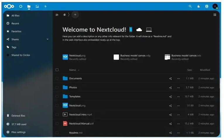
This tutorial will show you how to install #Nextcloud on a #Debian 12 server. You will install Nextcloud with Apache2 web server, MariaDB server, and PHP 8.2. Furthermore, you will also secure your #installation with UFW (Uncomplicated Firewall) and SSL/TLS certificates from Letsencrypt.
How to Install and Create a Chat server using Matrix Synapse and Element on Debian 12
Matrix is an open standard for #decentralized and end-to-end #encrypted #communication. It is a collection of servers and services that communicate with each other using a standardized API that synchronizes in real time. It uses homeservers to store account information and chat history. If one #homeserver goes down, other servers can continue communication without issues due to the nature of decentralization. You can either use a Matrix homeserver hosted by someone else or host your own to maintain control over your data.
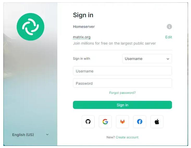
In this tutorial, you will learn how to install and create a chat server using Synapse, a homeserver implementation of Matrix. #Element is a #Matrix web client built using Matrix React SDK. This will allow you to offer Matrix chat on the web. You can also use the server using any other Matrix client of your choice. We will also be installing the Coturn server to enable Voice and Video calling. The #Coturn service is optional in case you are not interested in using it.
How to Install TYPO3 CMS on Debian 12
TYPO3 is a free and open-source Enterprise-grade content management system. It provides enterprise-level features such as a scalable CMS with multisite support, multilingual installations, strong security implementation, blazingly fast, and can be run anywhere.
Using #TYPO3 #CMS allows you to build flexible and reliable websites. The TYPO3 CMS is backend a vibrant professional community. By design, the TYPO3 CMS is a pluggable content management system with adaptable and decoupled architecture.
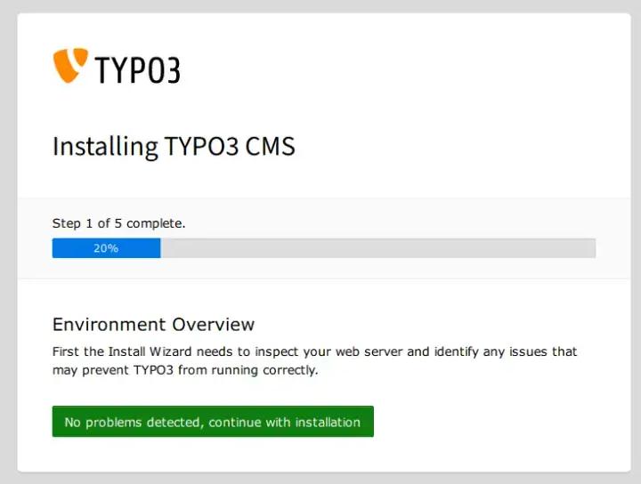
This tutorial shows you how to install the TYPO3 CMS on a #Debian 12 server on a #LAMP Stack (Apache2, MariaDB, and PHP).
https://www.howtoforge.com/tutorial/debian-typo3-apache-installation/
Peppermint Devuan ARM (Release)

Finally we have released our #Devuan #ARM, build for those in the in the community who wish to be #SystemD free…with your ARM architecture.
https://peppermintos.com/2023/10/peppermint-devuan-arm-release/
Zum Tode von Gunnar Kaiser
Der Schriftsteller und #Philosoph #Gunnar #Kaiser ist aus dem Leben geschieden.

Als die Welt im Frühjahr 2020 mit einem Schlag Kopf stand und die gewaltigen Veränderungen der Lebensverhältnisse anschließend gar kein Ende mehr nehmen wollten, gehörte Gunnar Kaiser zu jenen wenigen öffentlichen Personen, die den Verzweifelten Kraft und intellektuelle Orientierung gaben. Der Philosoph, Schriftsteller und ehemalige Lehrer erhob frühzeitig seine Stimme, stellte Fragen, unterhielt sich mit seinen Gästen, er kritisierte die gesellschaftliche Antwort auf das Corona-Virus insgesamt. Auch ich lauschte seinen Gedanken nach der Arbeit beim Kochen. Ich bin nicht allein, sah ich. Das tat gut.
Ricardas Wirtschaft

Für die #Grünen-Vorsitzende Ricarda Lang geht Wohlstandssicherung ganz einfach per Gesetz: Mindestlohn rauf und Mieten runter! Kennt sie grundlegende ökonomische Zusammenhänge wirklich nicht oder will sie einfach nur schnell in die staatliche Planwirtschaft?
Manchmal können einem die #Grünen ja fast leidtun. Alle Welt hackt auf ihren Ideen und Forderungen herum, und inzwischen gelten sie gemeinhin als #Wohlstandsvernichter und klimatisch verblendete Ideologen. Man möchte fast ein wenig Mitleid entwickeln. Und dann kommt #Ricarda #Lang. Die Grünen Co-Vorsitzende ließ aktuell verlauten, dass sie die geplante Erhöhung des #Mindestlohns um 82 Cent bzw. 6,8 Prozent für zu niedrig hält. Sie gab zu Protokoll, dass diese Erhöhung „ein Schlag ins Gesicht“ von Menschen sei, die wenig verdienen. Starke Worte für eine Studienabbrecherin, die sich normalerweise als potenzielles Mitglied dieser Gruppe qualifizieren würde.
Seuchengefahr forever: Grippe soll Corona ersetzen
Die #WHO erklärt Grippeviren zur #Menschheitsbedrohung, mRNA-Grippeimpfstoffe sind in der Studienphase, und #Drosten will wahllos auf #Viren testen, damit die nächste #Pandemie auch ja bemerkt wird. Mit dem #Pandemievertrag könnte 2024 alles von vorn beginnen.

Während die Seher des Mittelalters das katastrophale Ungewöhnliche prognostizierten, bescheiden sich die Seher heutiger Zeit mit der Ankündigung des Gewöhnlichen, das sie zur Katastrophe umetikettieren. „Die größte Bedrohung für die Menschheit ist die #Influenza“, orakelte WHO-Chef-Wissenschaftler Jeremy Farrar auf einer von der #Bundesregierung organisierten Konferenz, die Ende September in Berlin stattfand und medial bislang unbeachtet blieb. Mit der #Grippe drohe nicht weniger als eine „existenzielle Krise“; Jeremy Farrar spricht ernsthaft von „künftigen neuen #Influenzaviren, die ihm als größte Gefahr für die Menschheit erscheinen“. (Videoausschnitt hier.)
https://www.achgut.com/artikel/seuchengefahr_forever_grippe_soll_corona_ersetzen
Corona-Ticker: Wie das Narrativ absäuft

Das #Corona-Narrativ zerfällt wie ein Soufflé, wenn man zu früh die Backofentür öffnet. Kaum eine Behauptung, die nicht früher oder später widerlegt wäre. Die Aufarbeitung ist zwangsläufig. Hier einige Meldungen aus den letzten Tagen und Wochen.
Zu den Behauptungen der Coronisten gehörte etwa das Schlagwort vom „#Superspreader-Event“. Überall dort, wo Menschenmassen zusammenkamen, sei es auf Volksfesten, im Sportstadion, bei Konzerten oder Demonstrationen, habe die Gefahr bestanden, dass das #Virus massenhaft weiterverbreitet würde, deshalb verbot man diese Events häufig. Nun haben Wissenschaftler in einer Studie, über die nature berichtet, festgestellt: Politische #Massenveranstaltungen wirken sich nicht auf das #Infektionsgeschehen aus:
https://www.achgut.com/artikel/corona_ticker_wie_das_narrativ_absaeuft_11
Impfopfer: Brandmauer im Untersuchungs-Ausschuss
Vor dem Corona-Untersuchungsausschuss in Brandenburg offenbarte die PEI-Vertreterin erneut die inakzeptable Arbeitsweise ihrer Institution. Leider waren die Fragesteller den Vernebelungsmethoden der Verantwortlichen nicht gewachsen. Was die Aufklärer daraus lernen müssen, steht hier. Die #Achse war wieder vor Ort.

Am Freitag, dem 13. Oktober, fand im Brandenburger #Landtag die zweite Sitzung des #Corona-Untersuchungsausschusses statt, an der insbesondere Dr. Brigitte #Keller-Stanislawski Rede und Antwort stehen musste. Aus ihren Äußerungen kristallisiert sich ein System der Arzneimittelüberwachung heraus, in dem die #Pharmaindustrie stets im Vorteil ist. Im Grunde könnte man jedes problematische Arzneimittel einführen, auch jungen, gesunden Menschen präventiv verabreichen, indem man sich auf ein passives Meldesystem verlässt und die gemeldeten #Nebenwirkungen größtenteils bestreitet.
https://www.achgut.com/artikel/impfopfer_brandmauer_im_untersuchungsausschuss
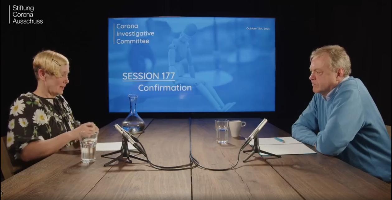
Dirk Pohlmann | Nordstream | Sitzung 177 vom Corona Ausschuss
13. Oktober 2023
Im Gespräch mit Dirk Pohlmann (Investigativjournalist, Dokumentarfilmer)
OpenWRT – DRAHTLOSE FREIHEIT
In der Artikelserie #OpenWrt möchte ich euch einen alternativen Weg aufzeigen – der Router bzw. das Modem von eurem ISP wird weiterhin die Verbindung ins Internet aufbauen und Funktionen wie Telefonie etc. bereitstellen. Dahinter bauen wir uns allerdings unser eigenes, privates Netzwerk auf – abgeschottet vom Netzwerk des ISPs. Eine modemlose FRITZ!Box 4040 wird mittels OpenWrt zum Kompagnon für ein DSL- oder Kabelmodem bzw. Router umfunktioniert.
·
The GNU Name System

Motivation
The Domain Name System today enables traffic amplification attacks, censorship (i.e. China), mass surveillance (MORECOWBELL) and offensive cyber war (QUANTUMDNS).
Unfortunately, band aid solutions such as #DoT, #DoH, #DNSSEC, #DPRIVE and the like will not fix this. This is why we built the GNU Name System (#GNS), a #secure, #decentralized name system built on top of #GNUnet.
Overview
The GNU Name System (GNS) is a decentralized database that enables users to securely resolve names to values. Names can be used to identify other users (for example, in social networking), or network services (for example, VPN services running at a peer in GNUnet, or purely IP-based services on the Internet). Users interact with GNS by typing in a hostname that ends in a top-level domain that is configured in the “GNS” section, matches an identity of the user or ends in a Base32-encoded public key.
Pressefreiheit herunterregeln mit der EU

Wenn die #EU an einem „Medienfreiheitsgesetz“ arbeitet, muss man sich um die #Pressefreiheit wohl Sorgen machen, denn selbige soll ja neu „reguliert“ und „harmonisiert“ werden. Sogar sonst unkritische Fachverbände äußern Bedenken, doch das Gesetz wird bald kommen.
Wenn auf EU-Ebene von „#Freiheit“ die Rede ist, lohnt es sich immer, näher hinzuschauen. Aktuell wird das „Europäische #Medienfreiheitsgesetz“ (European Media Freedom Act, kurz: #EMFA) auf den Weg gebracht. Die #EU-Kommission hatte das Gesetz am 16. September 2022 vorgeschlagen. Am 3. Oktober dieses Jahres wurde es nun in einer überarbeiteten Fassung vom #EU-Parlament mit 448 zu 102 Stimmen bei 75 Enthaltungen verabschiedet. Dadurch ist der Weg frei für die Verhandlungen über die endgültige Gesetzesform mit dem Rat, der sich im Juni 2023 auf seinen Standpunkt geeinigt hatte.
https://www.achgut.com/artikel/Pressefreiheit_herunterregeln_mit_der_EU
OpenbookCase
Dieses Projekt hat das Ziel, eine einfache und nutzerfreundliche Plattform zu bieten, um öffentliche #Bücherschränke in der Nähe zu suchen.
Auch ist es möglich, sich auf der #Webseite zu registrieren (nur wenige Informationen sind nötig!), um beim Erweitern der #Datenbank und bei der Qualitätssteigerung der vorhandenen Daten mitzuhelfen.

IWF-Vize macht deutlich: Digitales Zentralbankgeld soll auch zur Verhaltenslenkung dienen
Der Bayerische Ministerpräsident Markus Söder hat jüngst angekündigt, künftig per programmierten digitalen Zahlkarten für Asylbewerber deren #Konsumverhalten zu steuern. Eine Aussage des Vize-Chefs des Internationalen Währungsfonds (#IWF), Bo Li, zeigt, dass auf höchster globaler Ebene daran gedacht wird, das geplante digitale #Zentralbankgeld zu solchen Zwecken auch für größere Bevölkerungsgruppen und sogar für die jeweilige #Gesamtbevölkerung einzusetzen.

Bahn schließt analog Lebende von bezahlbarem Bahnfahren aus
Die #Bahn verkauft ab Oktober auch an physischen #Verkaufsstellen #Fahrkarten zum Sparpreis nur noch gegen Angabe eines #Namens und einer #Handynummer oder #E-Mailadresse. Der Staatsmonopolist begründet die Maßnahme zur besseren #Überwachung der Bewegungen seiner Kunden verlogenerweise damit, dass er diese besser über den Reiseverlauf informieren wolle. Bei Fahrkartenkauf über die Netzseite der Bahn sind diese ohnehin schon personalisiert.

Söder will in Bayern staatliche Verhaltenslenkung mit programmiertem Geld einführen
Bayerns Ministerpräsident Markus #Söder plant staatliche #Verhaltenslenkung mit programmiertem #digitalen #Geld für #Asylbewerber. Getreu der üblichen Strategie der #Bargeldabschaffer und #Sozialingenieure, bei den Schwächsten anzufangen, kündigte er an, abgelehnten Asylbewerbern nur noch spezielle #Bezahlkarten zu geben, die lediglich den Kauf bestimmter Waren und Dienste erlauben.

https://norberthaering.de/bargeld-widerstand/soeder-asylbewerber/
Wenn alle Demokraten im selben Teich fischen
Die meisten Parteien haben sich eindeutig auf die Seite der woken Trans*-Bewegung gestellt. Leider auch die Hauptstadt-CDU. Ist die Union gewillt, sich dem woken Trend zu widersetzen? Achgut.com veröffentlicht einen Auszug aus dem neuen #Buch „#Woke“ von Zana Ramadani und Peter Köpf

Es ist selbstverständlich gut und richtig, dass auch Parteien sich um #Minderheiten kümmern. Wenn jedoch deren überzogene Forderungen sich gegen die Interessen der Mehrheit richten und selbst die Union sich unterwirft, wird die Mehrheit den etablierten demokratischen #Parteien den Rücken kehren. Wem werden sie sich zuwenden?
https://www.achgut.com/artikel/wenn_alle_demokraten_im_selben_teich_fischen
Thermonuklearer Sprengsatz? Dirk Pohlmann vor UN-Sicherheitsrat mit neuen Erkenntnissen zu Nord Stream-Anschlag
Dirk #Pohlmann, unabhängiger Journalist, Autor und Dokumentarfilmer, hat am ersten Jahrestag der #Nord-Stream-Sprengung vor dem #UN-Sicherheitsrat brisante Erkenntnisse vorgetragen, die medial und politisch unbeachtet bleiben.
Demnach würden neue Beweise auf eine massive Sprengkraft bei dem Anschlag hindeuten, die um ein Vielfaches stärker war, als bisher angenommen und damit die Frage nach der Art des Sprengstoffs aufwerfen, sogar, ob eventuell auch nukleare Komponenten zum Einsatz gekommen sind. Dabei beruft er sich unter anderem auf den Schweizer Physiker Dr. Hans-Benjamin Braun und dessen Untersuchung. Dieser meinte in einem seiner jüngsten Interviews: "Eine Kilotonne #TNT ist mit herkömmlichen Sprengstoffen nicht zu erklären. […] Das war ein nuklearer #Sprengstoff, insbesondere ein thermonuklearer Sprengstoff. Das heißt Kernfusion, also eine kleine Wasserstoffbombe."
Zudem wurde der Sprengstoff in einer solchen Tiefe platziert, dass daraus nur eine Schlussfolgerung möglich sei, nämlich, dass der Anschlag staatlich organisiert war. Die in Medien vorgebrachte Theorie, dass eine ukrainische Gruppe Attentäter mithilfe eines kleinen Segelschiffs hinter dem wirtschaftlichen Terroranschlag stünde, sei aufgrund der neuen Daten, als unmöglich zu betrachten.
Zudem verwies er auf historische Fälle, die gezeigt hätten, dass die #USA schon vielfach aus wirtschaftlichen Gründen #Energiepipelines und Konkurrenten ins Visier genommen haben und ergänzte: "Spätestens, wenn es um russisches #Gas geht, haben die USA keine Verbündeten mehr, sondern Geiseln. Obendrein leiden einige Geiseln unter dem Stockholm-Syndrom, wie die derzeitige schwedische und deutsche #Regierung."
Manipulierte Statistik: Wie das Faeser-Ministerium rechte Angriffe auf Flüchtlingsheime erfindet
80 Angriffe auf #Asylunterkünfte verzeichnet das #Bundesinnenministerium für das erste Halbjahr 2023. Eine exklusive Recherche von NIUS deckt nun Bemerkenswertes auf: Bei einem Großteil der Taten spielten die #Flüchtlingsheime selbst überhaupt keine Rolle. Die Zahl der tatsächlichen Angriffe ist gering. Einen Beweis für einen als rechts verorteten Täter bei einem #Angriff auf ein bewohntes #Asylheim gibt es nur in einem einzigen Fall.

Manipulierte Statistik: Wie das Faeser-Ministerium rechte Angriffe auf Flüchtlingsheime erfindet | NIUS.de
Manipulierte Statistik: Wie das Faeser-Ministerium rechte Angriffe auf Flüchtlingsheime erfindetNiUS.de
Der Faktencheck des Faktenchecks zum Faktencheck
Im Maischberger-Talk verbreitet Klimaaktivistin Luisa #Neubauer #Fake-News und unterstellt sie ihrem Mitdiskutanten von der CSU. Und was machen die #Faktenchecker? Sie stümpern herum und müssen sich dreimal korrigieren.

Von der #Klimaaktivistin Luisa Neubauer, die auch Mitglied bei #B’90/Grüne ist, ist bekannt, dass sie ihr mangelndes Wissen in der Sache durch Meinungsstärke zu ersetzen pflegt. Deshalb ist das Postergirl des deutschen Ablegers der #Fridays-for-Future-Bewegung gern gesehener Gast in allen Polit-Talkshows – jedenfalls bei den Gastgebern. Zuschauer können ihren arrogant-näselnden Tonfall und ihre penetrante Larmoyanz eher weniger ertragen. Gründe, ihre Aussagen von der behaupteten #Klimakrise als größte Herausforderung der Menschheit bis zur monokausalen Erklärung dafür mal energisch zu hinterfragen, gibt es viele. Allein, der gemeine #Faktenchecker (wir berichteten unter anderem hier, hier und hier) – nicht nur in der öffentlich-rechtlichen Redaktionsstube – sieht es nicht als seine Aufgabe an, ergebnisoffen die nackten Tatsachen zu prüfen: Es kommt darauf an, die medialen Hätschelkinder zu hofieren und die Bösen zu überführen – wie Stefan Frank es hier einmal ausdrückte: „Die grüne #Partei hat immer recht“ – das muss am Ende herauskommen.
https://www.achgut.com/artikel/der_faktencheck_des_faktenchecks_zum_faktencheck
Terrain maps - osmand
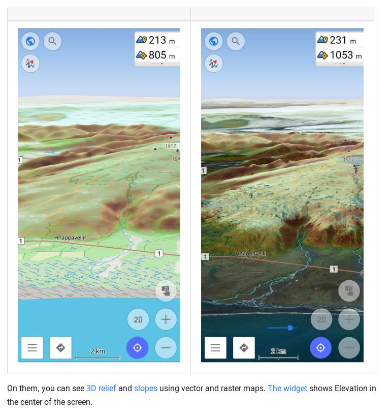
In the #OsmAnd 4.5 release, a new #terrain #map type has been added. This is a new data type in our application, which is needed for terrain rendering, and for some additional functions related to #elevations. All the information is in our documentation, but in this article, we will describe how and what you can see and get on the screen with a new data type.
Kordonzählung
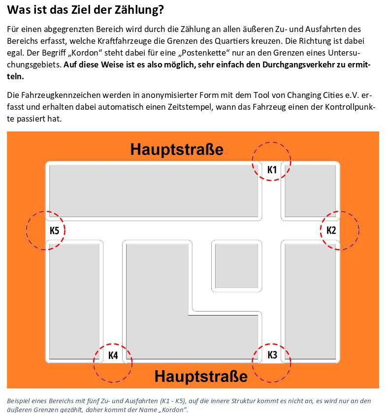
Mit Hilfe dieses Tools kannst Du den Durchgangsverkehr in deinem Kiez / deinem Wohnviertel ermitteln.
Datenschutz-konform werden dabei Teile der Kfz-Kennzeichen, der in den Kiez ein- und ausfahrenden Kfz erfasst. Nach dem Ende der Erfassung werden die Daten mittels Excel ausgewertet und der Anteil des Durchgangsverkehrs ermittelt.
GeoVisio - "like a self-hosted Street View"
#GeoVisio, aka #Panoramax, is a set of free and open-source tools to host geolocated pictures and serve them under standard STAC HTTPS API endpoints. In other words, it is "like a self-hosted Street View"[1] that does not impose its own app and gives you the right to fork the server. The basic architecture is exemplified in a diagram here.
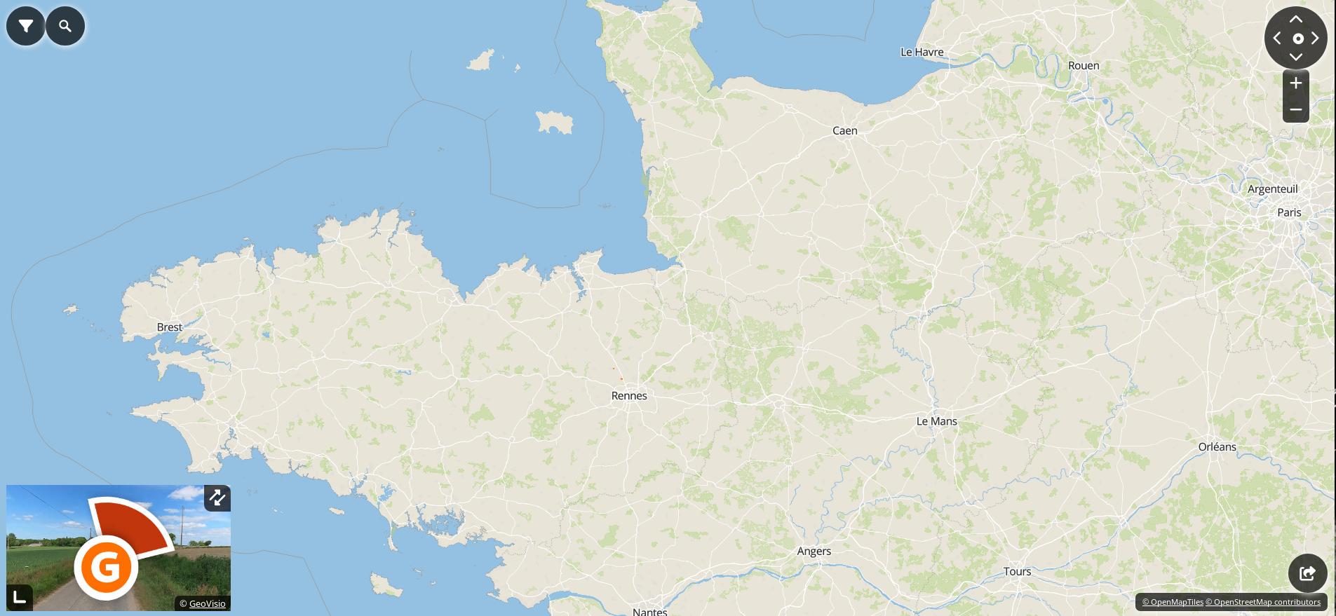
The main selling points are:
#self-hostable, as a public instance or in your private org
#free-licensed server (not even Mapillary or Mapilio have this)
#freedom to choose or develop your favorite client app
(#federation is a work in progress - public instances will be able to talk to each other and allow clients to circumvent Internet censorship, analogous to the Fediverse and Matrix)
US-Lieferung an die Ukraine : Was Uran-Munition bewirken kann

Die #Ukraine erhält Geschosse mit abgereichertem #Uran. Wie diese funktionieren und warum ihr "nuklear" klingender Name sie zum idealen Propagandamaterial macht.
Während des Überraschungsbesuchs von US-Außenminister Antony Blinken diese Woche in #Kiew wurde bekannt, dass die #USA der Ukraine 120-mm-Panzergranaten mit abgereichertem Uran liefern wollen.
[....]
Nach allem, was bis heute bekannt ist über die Effekte von Uran-Munition, stehen den militärischen Vorteilen bei der Durchschlagskraft durch Panzerung nur sehr begrenzte Risiken einer Vergiftung gegenüber.
https://www.zdf.de/nachrichten/politik/uran-munition-ukraine-krieg-russland-100.html#xtor=CS5-281
Was Uran-Munition bewirken kann
Die Ukraine erhält Geschosse mit abgereichertem Uran. Wie diese funktionieren und warum ihr "nuklear" klingender Name sie zum idealen Propagandamaterial macht.Christian Mölling, András Rácz (Politik)
Böhmermann und Schönbohm: Programmbeschwerde an den ZDF-Fernsehrat
Eine den ehemaligen Leiter des Bundesamts für Sicherheit in der Informationstechnik Arne Schönbohm desavouierende #Böhmermann -Sendung ist immer noch beim #ZDF aufrufbar, Persönlichkeitsrechtsverletzungen inklusive. Heute habe ich die nachstehende #Programmbeschwerde an den #ZDF-Fernsehrat gerichtet.

Es ist das eine, wenn man einen journalistischen Fehler macht, diesen eingesteht und korrigiert. Es ist etwas anderes, wenn man sich, mutmaßlich in konspirativem Zusammenwirken mit politischen Entscheidungsträgern im #Bundesinnenministerium, von diesem dienstfertig korrumpieren und instrumentalisieren lässt, um den Ruf und die berufliche Existenz eines unbescholtenen Amtsleiters (Arne #Schönbohm, ehemaliger Leiter des Bundesamts für Sicherheit in der Informationstechnik – #BSI) zu zerstören. Ein solcher journalistischer Schreibtischtäter ist der ZDF-Clown Böhmermann, bekannt für das ganz kleine intellektuelle Kartenspiel.
https://www.achgut.com/artikel/boehmermann_und_schoenbohm_programmbeschwerde_an_den_zdf_fernsehrat
Stars der Automesse preisen Bahn und Fahrrad
Natalie #Portman trat als #Stargast bei der IAA auf. Im Bühneninterview schwärmte sie vom Bahnfahren, VW-Chef Oliver Blume pries erschwingliche #E-Autos und die Chefin eines Radherstellers sang ein Loblied auf das #Fahrrad. Genauso habe ich mir eine #Automesse immer vorgestellt.

Normalerweise bringt mich der Beginn der Internationalen #Automobil-Ausstellung kaum in Verzückung. Schließlich verstehe ich von Autos in etwa so viel wie ein Hund vom Theater. Abgesehen davon registriere ich natürlich die traurigen Schlagzeilen, die regelmäßig den Tod des Verbrennungsmotors sowie unserer Automobilproduktion verkünden und selbst mir wird klar, dass ohne unsere wichtigste Industrie in #Deutschland wohl bald nicht mehr viel los sein wird. Außerdem überlege ich hin und wieder, wie hoch heutzutage die Wahrscheinlichkeit ist, dem Brand eines E-Autos zum Opfer zu fallen.
https://www.achgut.com/artikel/Stars_der_Automesse_preisen_Bahn_und_Fahrrad
Was Politiker wirklich über Aiwanger denken
Aus Gründen können #Politiker nicht sagen, was sie denken. #Achgut bietet seinen Usern daher einen einzigartigen #Übersetzungsservice. Erfahren Sie unter den Zeilen, was Sie sonst nur dazwischen lesen können.
Hinweis: Die Übersetzungen [jeweils in eckigen Klammern] erfolgten mit dem veralteten Werkzeug „Natürliche Intelligenz“. Einzelne Ungenauigkeiten sind daher nicht vollständig auszuschließen.

https://www.achgut.com/artikel/was_politiker_wirklich_ueber_aiwanger_denken
