StreetComplete
StreetComplete
OpenStreetMap-Erhebungs-App
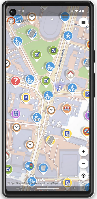
Hilf mit, die OpenStreetMap-Karte zu vervollständigen – mit StreetComplete!
Diese App findet fehlende Kartendaten in deiner Nähe und zeigt diese als Aufgaben auf einer Karte an. Jede dieser Aufgaben kann vor Ort durch Beantwortung einer einfachen Frage gelöst werden.
Die von dir eingegebenen Informationen werden dann direkt in deinem Namen zu OpenStreetMap hinzugefügt, ohne einen weiteren Editor benutzen zu müssen.

osm.el - OpenStreetMap viewer for Emacs
Osm.el is a tile-based map viewer, with a responsive movable and zoomable display. The map can be controlled with the keyboard or with the mouse. The viewer fetches the map tiles in parallel from tile servers via the curl program. The package comes with a list of multiple preconfigured tile servers. You can bookmark your favorite locations using regular Emacs bookmarks or create links from Org files to locations. Furthermore the package provides commands to search for locations by name and to open and display GPX tracks.

GitHub - minad/osm: osm.el - OpenStreetMap viewer for Emacs
:earth_africa: osm.el - OpenStreetMap viewer for Emacs - GitHub - minad/osm: osm.el - OpenStreetMap viewer for EmacsGitHub
Aktion Freiheit statt Angst mag das.
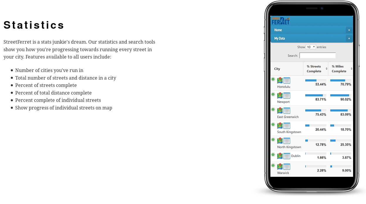
STREET FERRET - Explore your world
Have you ever wondered if it were possible to run or walk every street in your city? How many streets are even in your city? How many miles would you have to run in order achieve this feat? How much have you already completed? StreetFerret was designed to help you explore the world around you through running. We know you like to run with your phone, so StreetFerret is optimized for display on smartphones.

Overview over the various OSM-related Android apps
This page gives an overview over the various OSM-related Android apps. In order for an app to be listed it has to be available either on F-Droid or the Google Play Store.
https://wiki.openstreetmap.org/wiki/Comparison_of_Android_applications
Safe Cycling Map
A map showing how safe a street is for cycling, based on (arbitrary) metrics. See the key for how street safety is calculated.
This is a work in progress side project. This data is not guaranteed to be accurate.
When zoomed in close, individual road and bicycle lanes are shown. When zoomed out, streets are coloured by their safety ratings.
Disclaimer
Warning: This is an arbitrary rating system. Data is open source and not guaranteed to be accurate.
This map uses OpenStreetMap data. It is not a complete or accurate map of the world and should not be used in such a manner that deficiencies, omissions, inaccuracies or errors could result in death, loss or injury. The maps are an iterative ongoing work-in-progress and everyone is welcome to contribute editing the OpenStreetMap data if you spot inaccuracies. (warning courtesy of CyclOSM)
https://github.com/jakecoppinger/safe-cycling-map

GitHub - jakecoppinger/safe-cycling-map
Contribute to jakecoppinger/safe-cycling-map development by creating an account on GitHub.GitHub
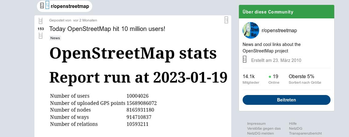
OpenStreetMap -- mehr als 10 Millionen Nutzerkonten
OpenStreetMap hat kürzlich einen Meilenstein mit mehr als 10 Millionen Nutzerkonten erreicht. Der Meilenstein wurde auf r/openstreetmap diskutiert. Es ist anzumerken, dass nur etwas mehr als 1,9 Millionen dieser Konten genutzt wurden, um eine Kartenbearbeitung vorzunehmen.

https://www.reddit.com/r/openstreetmap/comments/10fzlne/today_openstreetmap_hit_10_million_users/
Aktion Freiheit statt Angst mag das.


-jonny-
Als Antwort auf tom s • • •tom s
Als Antwort auf -jonny- • •About & Help
Acknowledgement
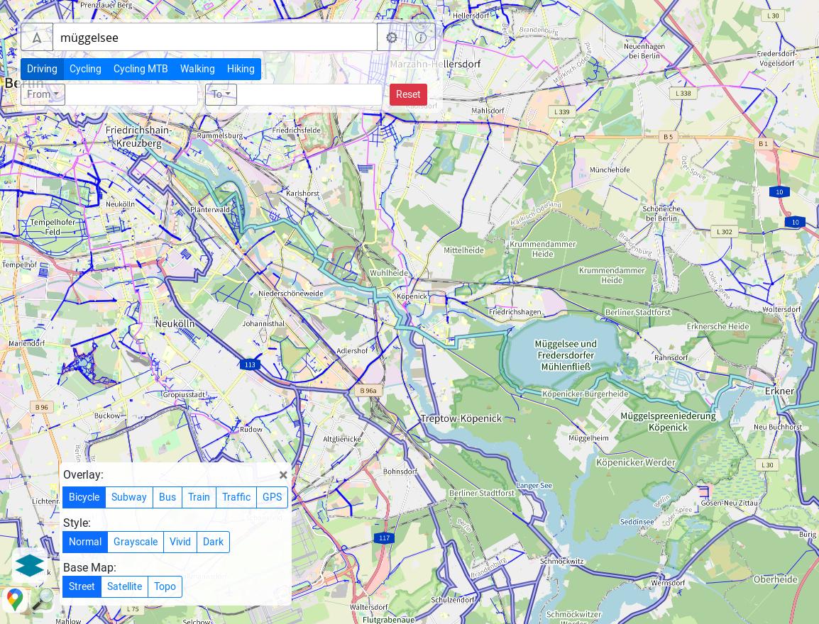
Map data: © OpenStreetMap contributors, © ESA WorldCover project / Contains modified Copernicus Sentinel data (2021) processed by ESA WorldCover consortium, NASADEM, SRTM
Map style: Tracestrack Tile Style based on OpenStreetMap Carto and OpenTopoMap
Satellite service provider: Mapbox
Search service: Nominatim
Map framework: OpenLayers
Query service: Overpass API
Routing: OpenRouteService
Traffic: TomTom
Some map icon credit: See Tracestrack Tile Style
Like to use the map tile service? Check out Tracestrack Tile Service
Contact: [tracestrack@icloud.com]
Privacy
We do not collect user data. Cookies are used only to save user preferences.
-jonny-
Als Antwort auf tom s • • •