StreetComplete
StreetComplete
OpenStreetMap-Erhebungs-App
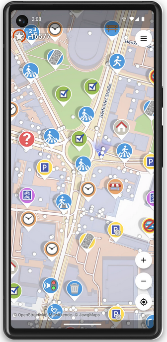
Hilf mit, die OpenStreetMap-Karte zu vervollständigen – mit StreetComplete!
Diese App findet fehlende Kartendaten in deiner Nähe und zeigt diese als Aufgaben auf einer Karte an. Jede dieser Aufgaben kann vor Ort durch Beantwortung einer einfachen Frage gelöst werden.
Die von dir eingegebenen Informationen werden dann direkt in deinem Namen zu OpenStreetMap hinzugefügt, ohne einen weiteren Editor benutzen zu müssen.
osm.el - OpenStreetMap viewer for Emacs
Osm.el is a tile-based map viewer, with a responsive movable and zoomable display. The map can be controlled with the keyboard or with the mouse. The viewer fetches the map tiles in parallel from tile servers via the curl program. The package comes with a list of multiple preconfigured tile servers. You can bookmark your favorite locations using regular Emacs bookmarks or create links from Org files to locations. Furthermore the package provides commands to search for locations by name and to open and display GPX tracks.

GitHub - minad/osm: osm.el - OpenStreetMap viewer for Emacs
:earth_africa: osm.el - OpenStreetMap viewer for Emacs - GitHub - minad/osm: osm.el - OpenStreetMap viewer for EmacsGitHub
Aktion Freiheit statt Angst mag das.
Overview over the various OSM-related Android apps
This page gives an overview over the various OSM-related Android apps. In order for an app to be listed it has to be available either on F-Droid or the Google Play Store.
https://wiki.openstreetmap.org/wiki/Comparison_of_Android_applications
Safe Cycling Map
A map showing how safe a street is for cycling, based on (arbitrary) metrics. See the key for how street safety is calculated.
This is a work in progress side project. This data is not guaranteed to be accurate.
When zoomed in close, individual road and bicycle lanes are shown. When zoomed out, streets are coloured by their safety ratings.
Disclaimer
Warning: This is an arbitrary rating system. Data is open source and not guaranteed to be accurate.
This map uses OpenStreetMap data. It is not a complete or accurate map of the world and should not be used in such a manner that deficiencies, omissions, inaccuracies or errors could result in death, loss or injury. The maps are an iterative ongoing work-in-progress and everyone is welcome to contribute editing the OpenStreetMap data if you spot inaccuracies. (warning courtesy of CyclOSM)
https://github.com/jakecoppinger/safe-cycling-map

GitHub - jakecoppinger/safe-cycling-map
Contribute to jakecoppinger/safe-cycling-map development by creating an account on GitHub.GitHub
UN Maps Learning Hub -- OpenStreetMap
A place to learn OpenStreetMap
Through the UN Maps Learning Hub, UN Mappers offers a self-training platform accessible to anyone discovering the OpenStreetMap project and wishing to participate in the improvement of this free geographic database as do many thousands of contributors each month.
This platform includes a series of courses to learn the basics of OpenStreetMap, its main editors and how to map its main geographic objects, including those encountered by UN Mappers on the territories of UN Peacekeeping missions covered by the UN Maps initiative.
These courses are independent of each other and can be accessed in any order, but beginners are advised to follow the suggested order. Each course is followed by a test that allows participants to evaluate their knowledge. You can easily get started by clicking on one of the course thumbnails below.
In the future, UN Maps Learning Hub will also offer OSM mappers the opportunity to obtain a certification of their theoretical and practical skills. Obtaining the UN Mappers certificate implies both passing an evaluation test covering all the knowledge transmitted in the courses of this Moodle and fully mapping several UN Mappers project tasks in different contexts. These tasks will be reviewed by UN Mappers team who will provide feedback on improvements or complements to be made if needed.
OpenStreetMap -- mehr als 10 Millionen Nutzerkonten
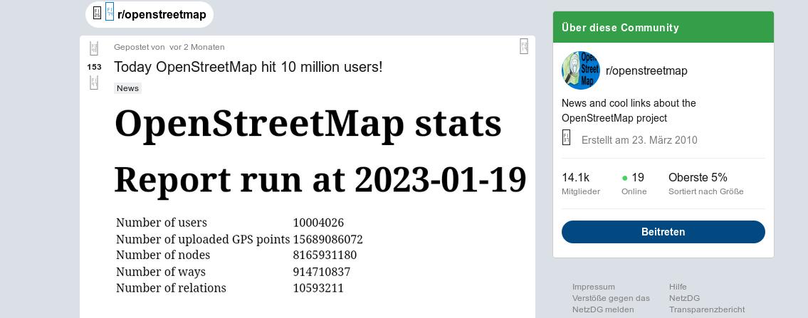
OpenStreetMap hat kürzlich einen Meilenstein mit mehr als 10 Millionen Nutzerkonten erreicht. Der Meilenstein wurde auf r/openstreetmap diskutiert. Es ist anzumerken, dass nur etwas mehr als 1,9 Millionen dieser Konten genutzt wurden, um eine Kartenbearbeitung vorzunehmen.
https://www.reddit.com/r/openstreetmap/comments/10fzlne/today_openstreetmap_hit_10_million_users/
Aktion Freiheit statt Angst mag das.
Powerful map based POI search WhatIsWhere
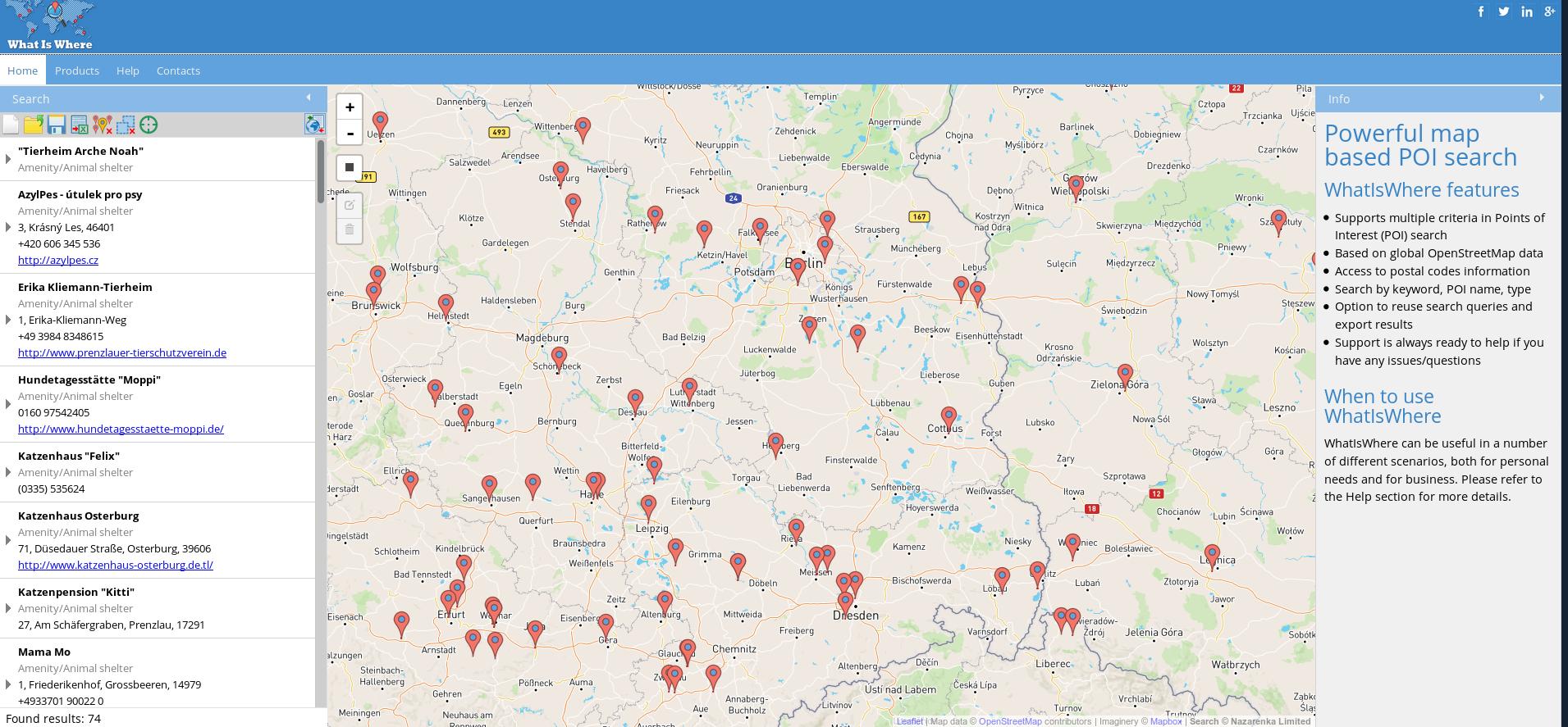
Powerful map based POI search
WhatIsWhere features
Supports multiple criteria in Points of Interest (POI) search
Based on global OpenStreetMap data
Access to postal codes information
Search by keyword, POI name, type
Option to reuse search queries and export results
Support is always ready to help if you have any issues/questions
When to use WhatIsWhere
WhatIsWhere can be useful in a number of different scenarios, both for personal needs and for business. Please refer to the Help section for more details.
MapSCII - The Whole World In Your Console
A node.js based Vector Tile to Braille and ASCII renderer for xterm-compatible terminals.
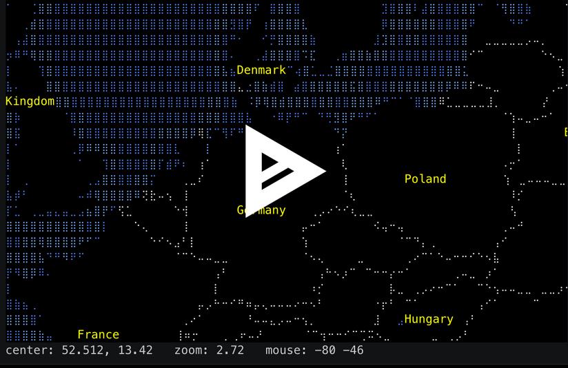
https://github.com/rastapasta/mapscii
GitHub - rastapasta/mapscii: 🗺 MapSCII is a Braille & ASCII world map renderer for your console - enter => telnet mapscii.me
🗺 MapSCII is a Braille & ASCII world map renderer for your console - enter => telnet mapscii.me <= on Mac (brew install telnet) and Linux, connect with PuTTY on Windows - GitHub - rastap...GitHub
